Walking the Jeju Olle: Korea’s Coastal Path, Route by Route
A former journalist came home from the Camino de Santiago in 2007 and began marking a path around her island. It now runs 437 kilometres in 27 routes. How to choose a section and where to stay.
Jeju is a volcanic island off the south coast of Korea, an hour by air from Seoul. Koreans have long gone there for honeymoons and golf. Since 2007 many have gone to walk. The Jeju Olle Trail follows the coast all the way round the island, and it has changed the way the island is seen.
How it began
The trail was the idea of Suh Myung-sook, a journalist born on Jeju who had spent her career in Seoul. In 2006 she walked the Camino de Santiago in Spain and decided to make a path of the same kind at home. The first route opened in 2007. Volunteers cleared and marked the rest over the following years.
Olle is a word of the Jeju dialect for the narrow lane, walled with black lava stones, that leads from the road to the door of a house. The trail keeps to that scale. It links old lanes, field paths, fishing harbours, beaches and the slopes of the small volcanic cones called oreum, and avoids roads where it can.
How it works
There are 27 routes with a total length of 437 kilometres: 21 that make the circuit of the island, and six on side trails and smaller islands. A route averages 16 kilometres and takes five to six hours. Each has a start, a midpoint and a finish where walkers stamp a trail passport. Those who collect them all receive a certificate.
The way is marked with ribbons tied in pairs, blue for the sea and orange for the island’s tangerines, with arrows painted on walls and stones, and with small blue figures of a pony. The pony is called Ganse, from a dialect word for a slow idler, which is how the founders hope the trail will be walked.
Which routes
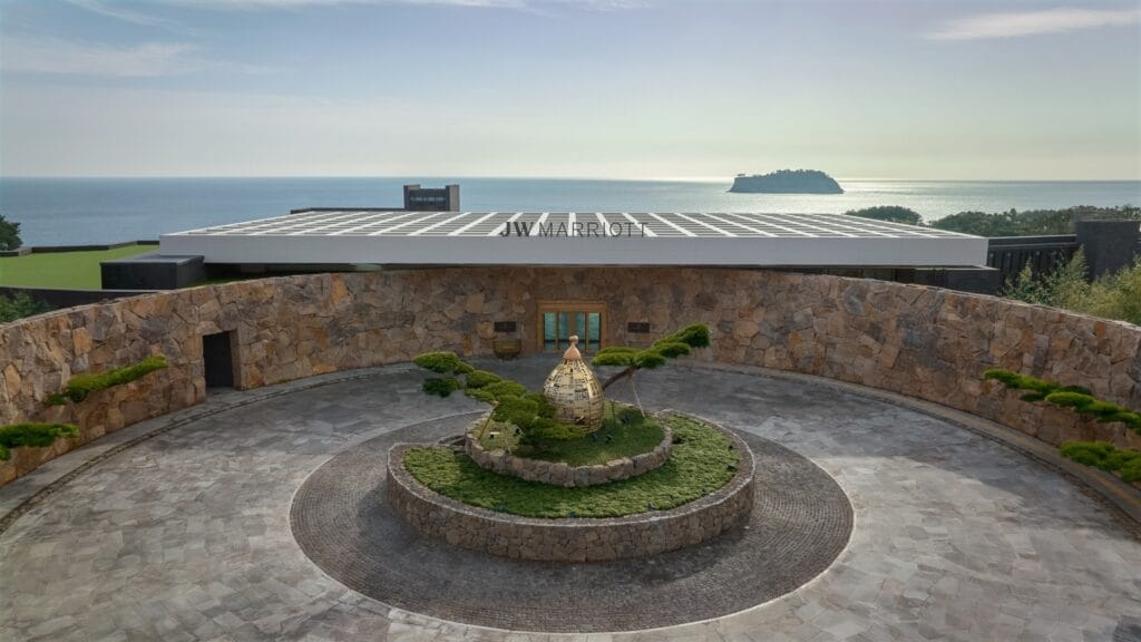
Route 7, on the south coast from Seogwipo, is the most popular. It passes the sea stack of Oedolgae, cliffs of columnar basalt and a shore of black rock pools. The JW Marriott Jeju, designed by Bill Bensley, stands beside this route.
Route 10, in the south-west, crosses dunes and lava flats below the bell-shaped mountain of Sanbangsan and looks out to the islands of Gapado and Marado.
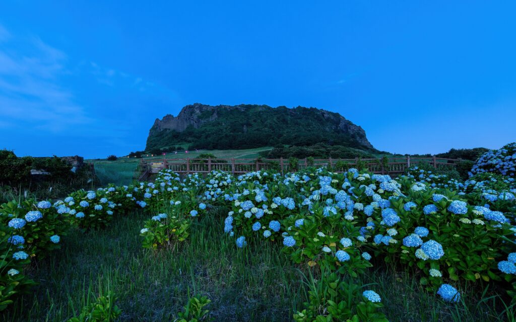
Route 1, in the east, climbs two oreum for a view of Seongsan Ilchulbong, the crater that rises from the sea, and is the best introduction to the farmland of the island.
The side route on Udo, a small island reached by ferry, makes an easy half day.
What you see
The trail passes the villages of the haenyeo, the women who dive without breathing equipment for abalone and sea urchins, many of them over sixty. Their catch is sold at the harbours. Other constants are the stone walls that divide the fields, tangerine orchards, and Hallasan, the volcano at the centre of the island, the highest mountain in South Korea.
Practical advice
Spring and autumn are the best seasons. Summer is hot and humid and brings typhoons. Buses run round the coast, and taxis are cheap, so it is easy to stay in one hotel and walk different routes on successive days. Walkers who want a city base can use Jeju City, where the Grand Hyatt Jeju occupies the island’s tallest tower. A passport and guidebook are sold at the trail’s office in Seogwipo. For a walk of a more inward kind elsewhere in Korea, see our account of a night in a Buddhist temple.
Continue
More from Jeju
 South KoreaJejuKorea's volcanic island, circled by the 437-kilometre Olle walking trail, with lava coasts.Read →
 News · TravelJW Marriott Jeju Opens on the Cliffs of SeogwipoBill Bensley's first project in Korea opened in spring 2023 with 197 rooms.April 6, 2023Read →News · TravelGrand Hyatt Jeju Opens in Jeju Dream TowerWith 1,600 rooms, 14 restaurants and bars and the island's largest pool deck.December 18, 2020Read →News · CultureJeju’s Haenyeo, the Women Who Dive Without Air, Join UNESCO’s Heritage ListOn 30 November 2016, in Addis Ababa, UNESCO inscribed the culture of the haenyeo.November 30, 2016Read →